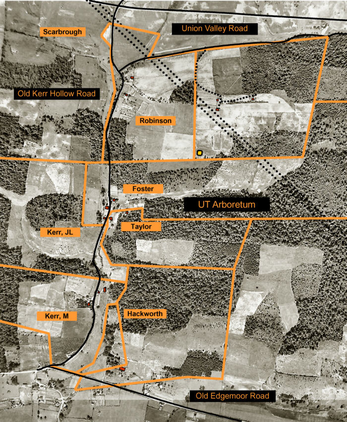
Environmental and land use stewardship has always been an important aspect of the UT Forest Resources Center and Arboretum mission. Responsible stewardship begins with a knowledge of past land use. Through the years, the Arboretum has collected valuable historic information about the property, including early 20th century aerial photos, oral histories from early residents, property plat plans, and photographs. Our “Kerr Hollow Heritage Trace” highlights the properties of the original residents of what was known as Kerr Hollow.
Arboretum visitors who walk along Old Kerr Hollow Road are actually following the original road used by the residents who occupied the area before it became federal property under the Manhattan Project.
Kerr Hollow History
The UT Arboretum’s Kerr Hollow Heritage Trace is a tribute to the families who lived within this area of Oak Ridge, TN, now part of the Arboretum, before the land was purchased in 1942 for development of the Manhattan Project.
The word “hollow” was the name local people gave to this valley through which the Scarbrough Creek runs. The valley completely bisects Chestnut Ridge. In geology terms, this type of valley is referred to as a “water gap.” Chestnut Ridge lies between Union Valley to the North and Bethel Valley to the South. Kerr Hollow is drained by Scarbrough Creek, which eventually empties into the Clinch River and along its meandering path passes through the site of the old community of Scarbrough.
Kerr Hollow derived its name from the Kerr family, whose farm and homestead were located along the creek. The section of State Route 62 that runs along the Arboretum was originally named Kerr Hollow Road, but in 2001 the city of Oak Ridge renamed it South Illinois Avenue.
According to accounts from Kerr family descendents, Joe Lee Kerr and his wife Mary Mollie Walters Williams Kerr bought the 140 acre farm in March of 1925 from a real estate firm in Knoxville for $14,000. Before the purchase, the Kerr’s and five of their children had lived in Corbin, Kentucky where Joe Lee worked for the L & N railroad. After coming to this area, two more children were born.
In addition to the properties owned by Mollie Kerr and her brother J.L. Kerr, five other families owned property in the hollow, contained within the UT Arboretum grounds, when the area was purchased by the government in 1942. The Clyde E. Foster house was located on the site of the present day Arboretum Visitors Center and the J. Walters Taylor property was located just below the Foster house. The Taylor house, a log cabin style structure dating from the late 1830s, was originally owned by the Winchester family. The Foster house was previously owned by the Gorman family. Gorman and Winchester family photos taken during the 1920’s period were provided by descendants and are on display in the lobby of the Arboretum Visitors Center. Farther up the hollow from the Visitors Center was the Josie Robinson farm and up and across the road was the W.R. Scarbrough family. Scarbrough (also spelled Scarboro) Creek bears the family’s name. The H.H. Hackworth property was located across the road from the Kerr farm.
Kerr Hollow Properties
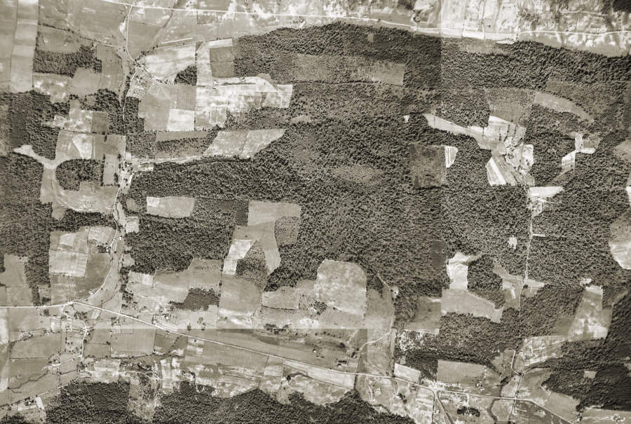
In 1942 – the year that the federal government acquired property for the Manhattan Project – there were seven properties that fronted on the portion of Kerr Hollow Road that now lies within the borders of the Forest Resources AgResearch and Education Center. The information and photos presented were generously provided by Mr. Daniel Raby whose family owned property in the area. More information about the Manhattan Project and Mr. Raby’s collection of photos taken by the federal government is available at various locations in the area and in many publications – some available at the Oak Ridge Public Library.
Descriptions and photos of all of the properties were taken at the time the government purchased them for the Manhattan Project. We are presenting these photos as digitized by Mr. Raby from the original government photos and have only made minor adjustments in size and clarity. A 1942 aerial photo and map of the property locations is also available.
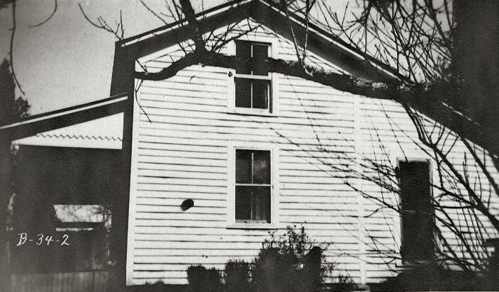
Clyde E. Foster Property (Plot E 404)
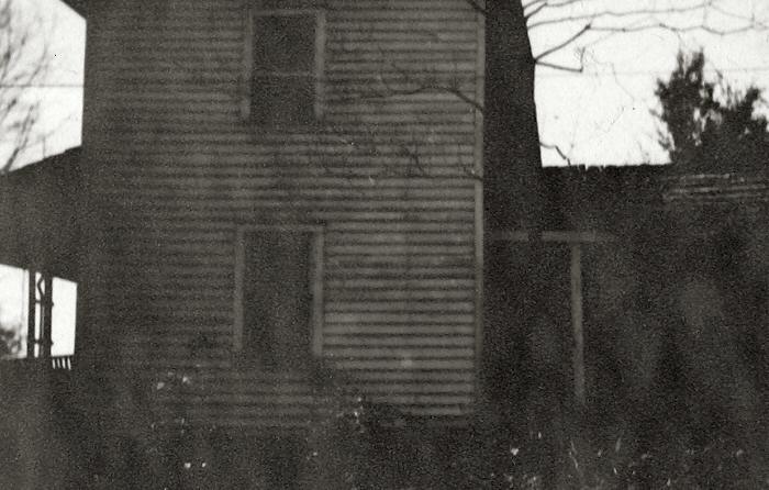
The Clyde E. Foster house was located on the site of the present day Arboretum Visitors Center. The government inventory for the property lists the house, barn, smokehouse, hen house, and privy. The structures on this property were evaluated by the government as being in fair condition – giving them a value of $1,250.
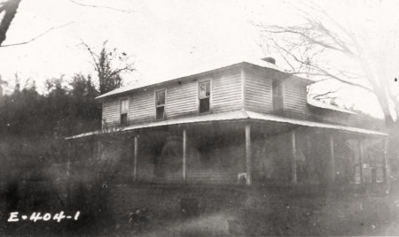
House Dwelling 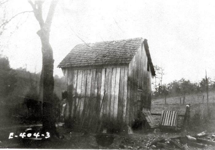
Smoke House 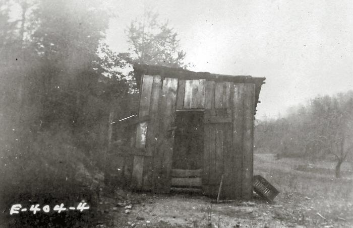
Hen House 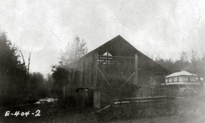
Barn 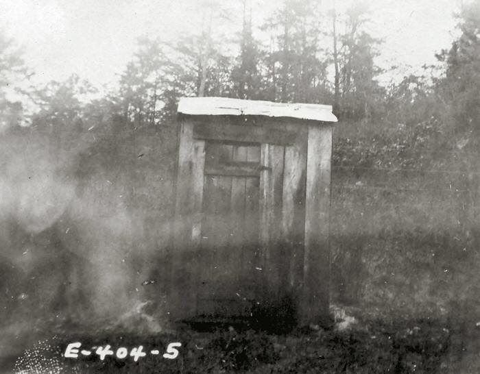
Privy
H.H. Hackworth Property (Plot E 419)
The Hackworth property had the newest main dwelling of all the properties along Kerr Hollow Road. However, the federal government’s inventory evaluation of it was just $850. There were only two other structures on this property – a smokehouse/shed and a privy.
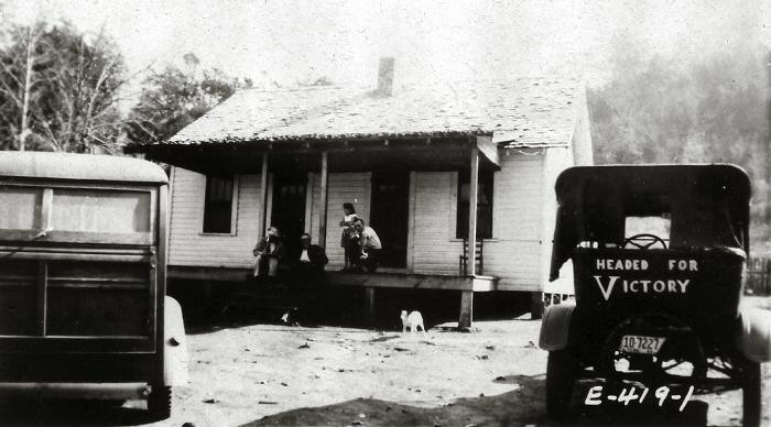
Dwelling Front Porch 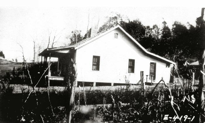
Dwelling Side View 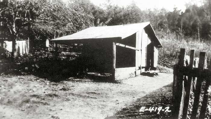
Smoke Shed 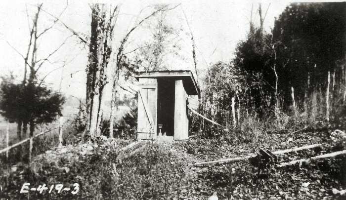
Privy
Mollie Kerr Property (Plot E 426)
The Mollie Kerr house was the first property on the left just up from the junction of Kerr Hollow Road with Edgemoor Road. The government inventory for the property lists the house, a tenant house, barn, smokehouse, garage, hog house, chicken house, stable, and privy – all evaluated by the government as in fair to good condition. The main dwelling was evaluated at $1,000 which made it one of the highest evaluations along the road.
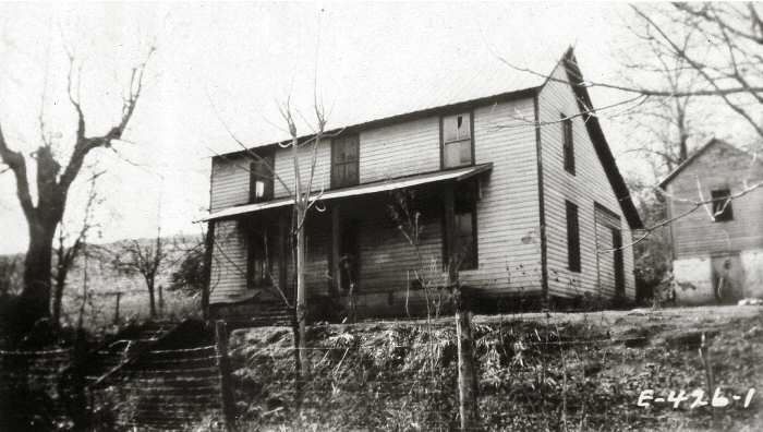
Dwelling 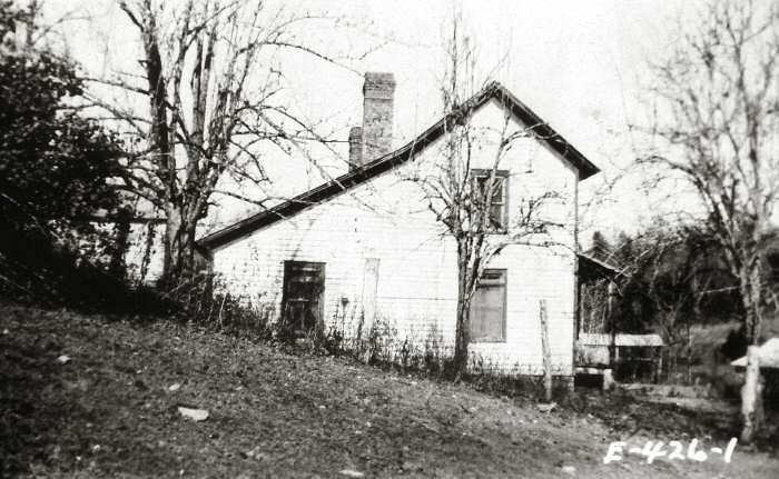
Dwelling Side View 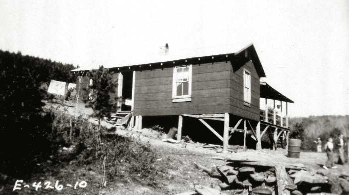
Tenant House 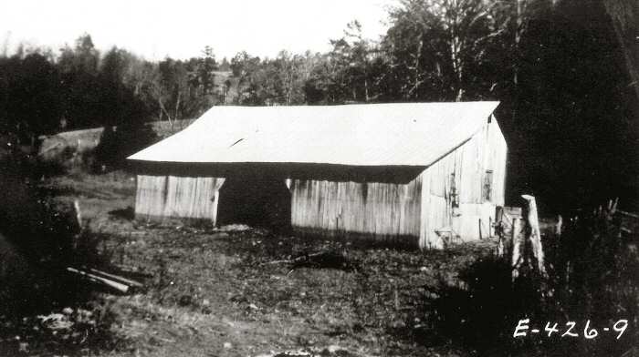
Barn 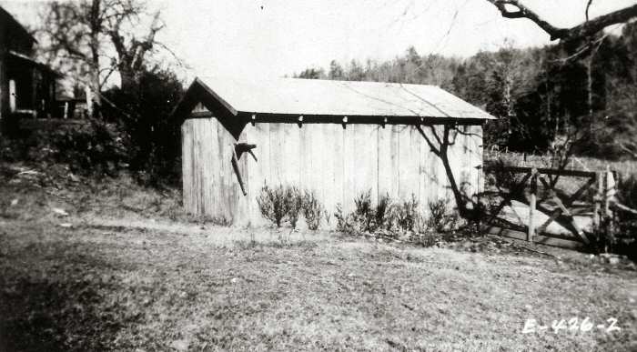
Garage 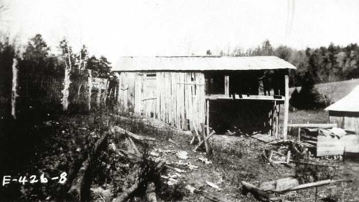
Stable 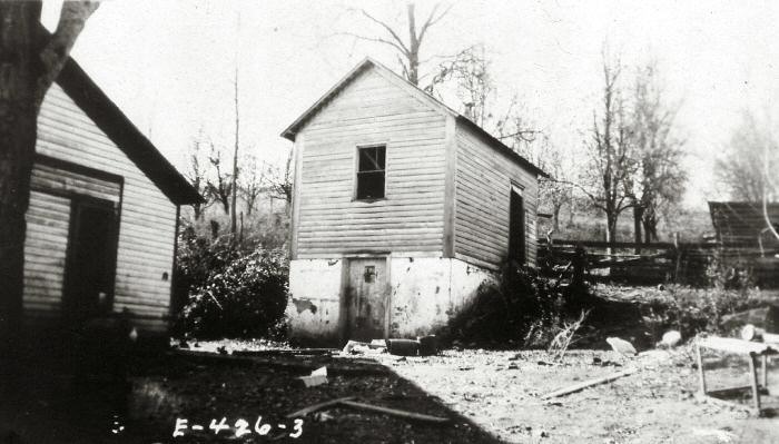
Smoke House 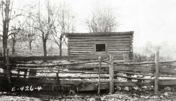
Hog House 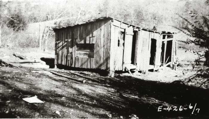
Chicken House and Crib 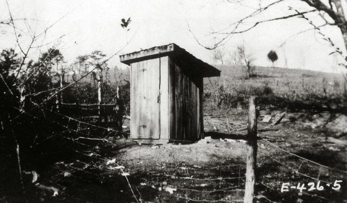
Privy
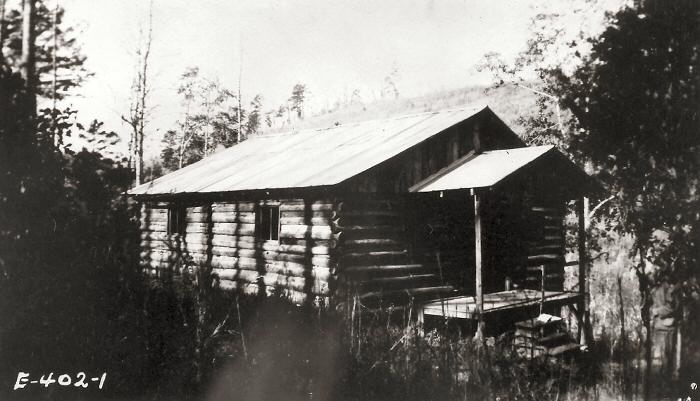
J.L. Kerr Property (Plot E 402 and E 427)
The JL Kerr property was “just up the road” from the Mollie Kerr house on Kerr Hollow Road. Actually, there were two parcels associated with J.L. Kerr – one containing the dwelling and some outbuildings and the other had what was listed as the “central office”. The inventory list for the two properties includes the house, garage, chicken house, and privy on one site; and the central office plus another privy on the other site.
Dwelling 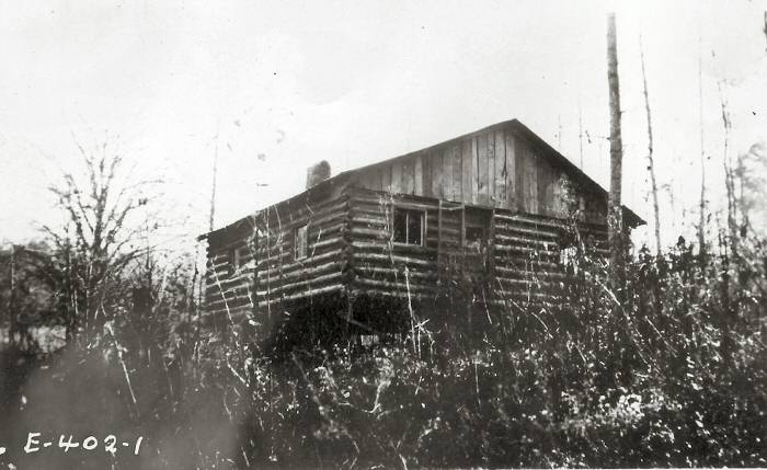
Dwelling Side View 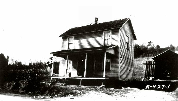
Central Office 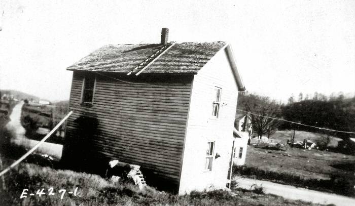
Central Office Rear 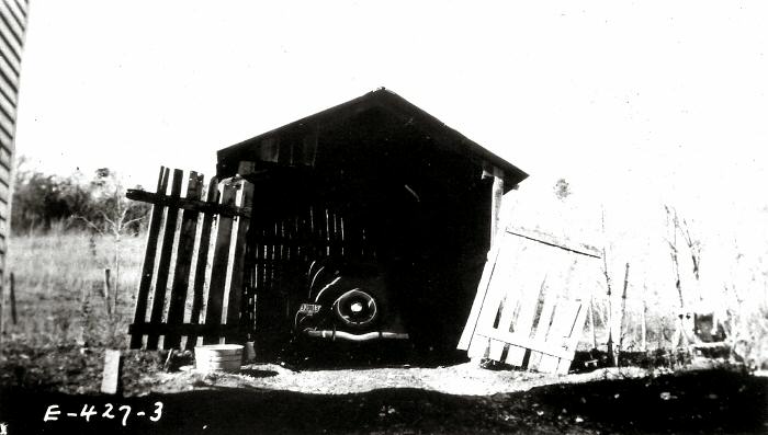
Garage 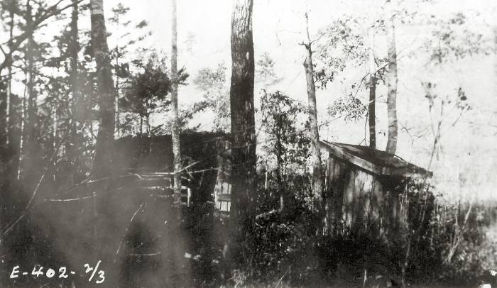
Chicken House and Privy 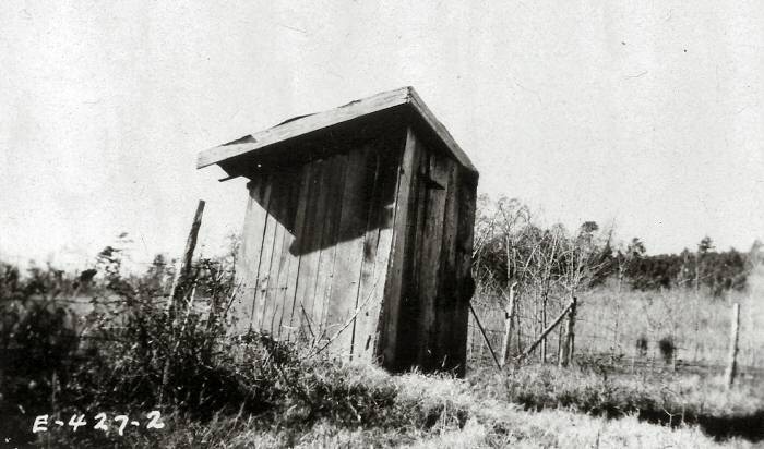
Central Office Privy
Josie Robinson Property (Plot B 134)
The Robinson property was located across from the Scarbrough property. There were seven structures – most in poor to fair condition including the main dwelling. Of particular interest on this property was the Spring House located on the site of the spring feeding the creek that parallels Kerr Hollow Road. The total value of the Robinson property was $1,110.
Dwelling 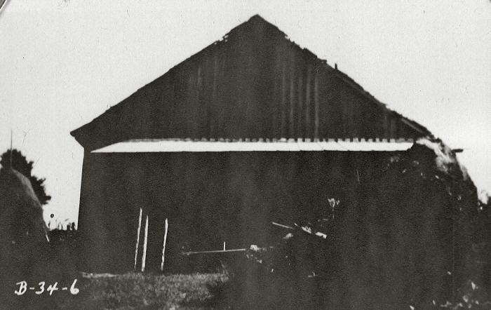
Barn/Shed 
Shop 
Spring House 
Privy
W.R. Scarbrough Property (Plot B 132)
This property was located on the left side of the upper portion of Kerr Hollow Road. There were eleven structures located on the property including the main dwelling and many outbuildings. Most of the outbuildings were evaluated by the government as being in poor to fair condition. The total value of all the structures was just over $1,000.
Dwelling 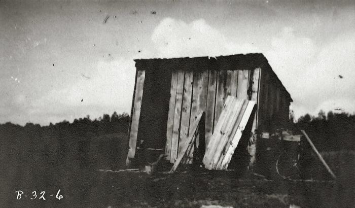
Shop 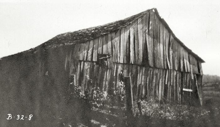
Barn 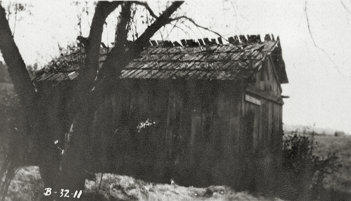
Stable 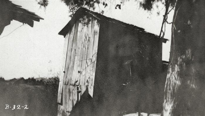
Smoke House 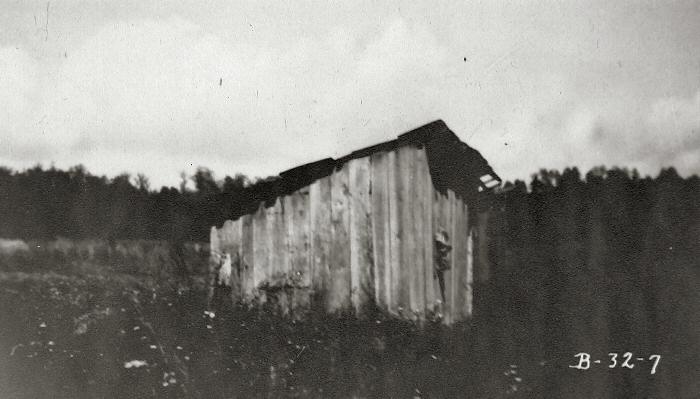
Poultry House 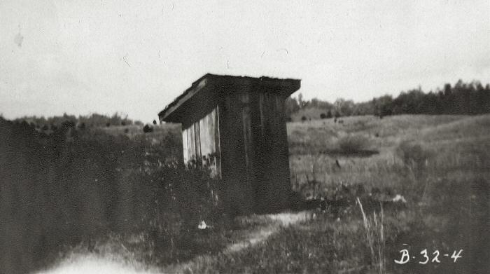
Privy
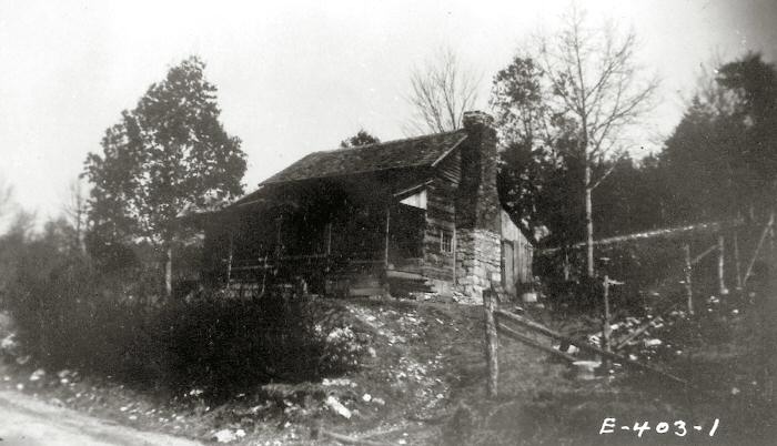
J. Walters Taylor Property (Plot E 403)
The Taylor property was located just below the Foster house. The Taylor house was previously owned by the Winchester family who built the log cabin style house. There is a display in the main lobby at the UT Arboretum Visitors Center of photos and artifacts of this house dating from the mid-1920’s. The inventory list for the property includes the house, a second dwelling, barn/garage, hen house, and privy. The value for all of the structures was less than $750.
Dwelling 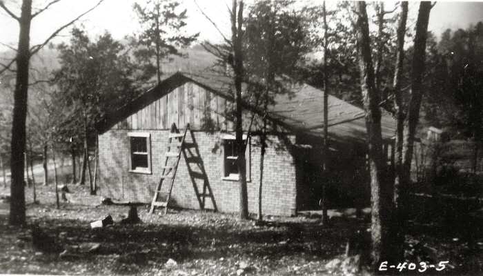
Second Dwelling Side View 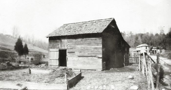
Barn/Garage 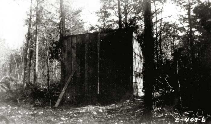
Hen House 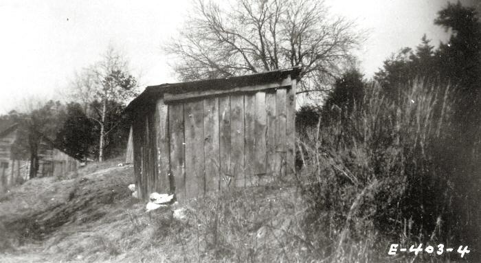
Chicken House 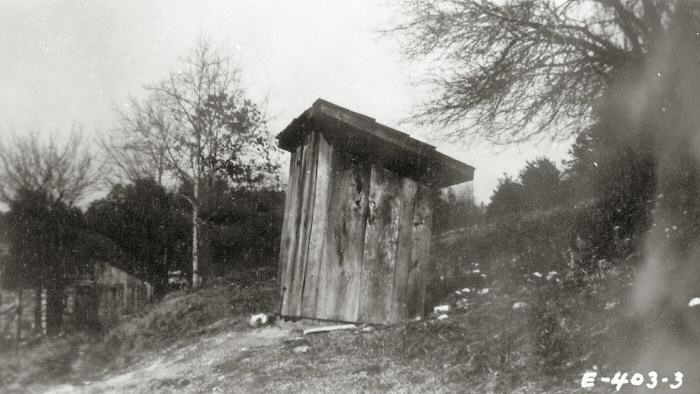
Privy
Kerr Hollow Oral Histories
Oral History by Vivian Lillian Kerr Young
I am Vivian Lillian Kerr Young, Born June 25, 1925 in Kerr Hollow, Scarboro. The address was Rt 1 Edgemoor, TN. My parents came from Corbin KY. in March of 1925. My Father Joe Lee Kerr was a railroader, his hobby was horse trading. Mother’s hobbies were knitting, playing piano, sewing and reading the Bible. She also played the ju-harp. Popie, as we called our dad, would work the L&N railroad from Corbin to Etowah, and was home every two weeks for a few days. Momie had to manage the farm and children most of the time by herself. The children at home was Joe Edward, Joe Lee Jr., Lula J., Vivian Lillian, and Thomas Hoover, and two of Momie’s grandchildren, Kenneth and Margaret Williams.
Our house was a two story with four rooms downstairs and two rooms upstairs. There were 2 chimneys with 3 fireplaces, telephone in the hallway and a place for cook stove. Off the kitchen was a small pantry. The front of the house faced the road with concrete steps leading down to the road. Outbuildings consisted of chicken house, outhouse, cellar, smokehouse, corn crib beside the road and a barn close to the creek that ran the length of farm. Kerr Hollow at Scarboro was a nice community with good people. The neighbors was always helping. Our farm also had 3 other houses, one was torn down in the 30’s. The house near the main road at one time was telephone office then later became a grocery store rented by Edgar and Susie Ford. Across the road was another grocery run by Hobart and Bessie Brimer. Back of there store was their house. Over from the Brimer house was Roy and Julie Scarbrough, later Edgar and Susie Ford moved next door to the Scarbroughs. Down the hill lived Roy Ivals, across the road L.A. Freels, down from them the Paris Lea family, then Mr. & Mrs. Thorpe. The Gans family ran a grist mill, that the community used for making corn meal.
Before getting to the Scarboro school was Dr. & Mrs. Lea’s house. Over from the grammar school was a lodge hall and the Burgess house and Methodist church. Going toward Solway we had another grocery store run by Jim and Frances Freels. Grandma and pa Freels house was across the creek from our farm. Also Mrs. Lockett’s house was across the road from the end of the Kerr farm. Across from Jim Freel’s grocery store, was the Presbyterian church.
Things I remember about Momie and Popie. Momie would take us opossum hunting. She would invite the children in Scarboro to go too. Also, she always killed the hog for meat by hitting it with a single edge axe, then stick it with butcher knife. The neighbor, Gaint Keith, would help her get it upon the hanging poles there she would finish. Many times she would tell us about the stars and big dipper and seven sisters, and heard her pray for one of us to get well when we was sick. Popie always was fixing fences when he got to come home, and lots of times he would take us to tent meetings in the wagon. Later he taught me to drive a car. They always encouraged us to read the bible and learn in school.
When my brother Thomas Hoover and I were small, Momie had some problems with a neighbor Mr. Gourmly. He broke into our house and tried to make Momie give him a key to unlock the telphone house. Popie had locked the doors. Momie said that he got rough with her, so the next day when he went by our house she took her rifle and shot at him. He had her arrested but the Judge told her “next time get something you can reach him with”. From then on Mr. Gourmly took the woods to pass our house.
Joe Lee Kerr’s father was from Scotland. Mary Mollie Walters Williams Kerr’s people were Cherokee Indians. They were born in Whitley County, Kentucky. Joe Lee in 1881 and Mollie in 1882.
Oral History by Joe Edward Kerr
My name is Joe Edward Kerr. I am the 7th child of Joe Lee and Mollie Kerr. My brothers and sisters at the time our parents bought the farm on Kerr Hollow Road were Everett, Snow, Lizzie, Cecil, J.L., Lula, and later came Lillian and Tom.
The Kerr clan bought the 140 acre farm in March of 1925 from a real estate firm in Knoxville for a contract of $14,000. The house was occupied by people by the name of Ellis who were renters. We lived at Corbin, Ky, before purchasing the farm.
At the time of moving, our furniture was shipped by the L & N Railroad to Solway, which was about 4-5 miles from the house. My brother and I were driving a 1921 Ford 3 door touring car from Corbin. We had several ducks and chickens and two pigs in the back seat. We left Corin early one morning at the same time our dad rode a horse and had two young mules following he and the horse. At the time, U.S. 25 was a narrow gravel road with no bridges across the creeks. My brother Evert and I were fording a creek near Jellico, TN when a front universal joint broke. We got a farmer to pull the car from the creek onto the side of the road. At about 3 pm, our dad caught up with us on his horse. He went on a bus to Knoxville and bought a universal joint and brought it back the next day. Then Evert and I repaired the car and continued on to the farm. My dad was at the farm by the time we arrived late that day. My Mother and sisters and younger brother, Lula and J.L. came to Solway by train from corbin, Ky. They were picked up by a neighbor in a buggy from the depot.
Oral History of Mrs. Ruth Kesterson Lackey
Visit of Mrs. Ruth Kesterson Lackey to the UT Arboretum on October 22, 2003
Mrs. Lackey stopped by the office and, in conversation with myself, gave the following information on the previous history of residents of the Oak Ridge Forest Resources Center properties pre-AEC. Mrs. Lackey’s father was Sam Kesterson, a coal miner who worked in the mines near Lake City. She was born (1935) in a house near the present location of the Food Lion Store on Emory Valley Road (Emory Heights, or Lupton Cross Roads at that time). Her grandparents also occupied a house in that vicinity. Soon thereafter they moved to a house that was possibly located within the Forest Resources Center, near (across from, she said) the house of Aunt Jos (last name unknown), as she called her.
Aunt Jos was said to be a black lady who, from earlier reports that I’ve received, lived in a house that stood near the present location of the Kosa dogwood study, powerlines, and UT Chestnut Ridge Road. Aunt Jos was said to be the daughter of a slave and came from South Carolina. Mrs. Lackey said that Aunt Jos had a daughter-in-law, Ann Robinson and her son Cood. She related that she considered them family, and that there was a reciprocal respect between the two families. I have heard from other area residents that occasionally a man who would be driving a Cadillac automobile with South Carolina license plate would visit Aunt Jos. He was reported to stay for a few days.
Mrs. Lackey vividly remembers walking the Old Kerr Hollow road from her house to her previous house at Emory Heights and the near-by house of her grandparents. She attended the Old Scarborough School and was transported to and from by bus.
After AEC bought-out her father’s property, they moved to Coalfield. She is now a resident of Oliver Springs, although she has also lived elsewhere. She said that her father moved them and their belongings to Coalfield by wagon. Also, she recounted that her father contested the price the Government offer him for his property in Oak Ridge, and subsequently, his property was further de-valued.
She recalled the prominence of the bootleggers that had a still in the vicinity (possibly near/along Kerr Hollow Road in the Pine Ridge area). She recalled the place was called the “Buzzard Roast”, which I previously heard was in the vicinity of (or, at) the “JLS” tombstone (thought to be that of John Lupton Scarboro) on top of Pine Ridge at the gap of the Old Kerr Hollow Road crossing. She remembered the JLS Cemetery, although I’m not certain her recollection was exactly clear on its location.
From her description of her home place on the Forest Resources Center property, the exact location is not exactly clear to me. The 1936 aerial photos did not show another house near the supposed location of the Sands homeplace. She said that there was a spring near their house, and I do not think there was a spring near the Sands’ house, nor does the topography suggest this, because it is near the top of the ridge. I think, from her recount of the setting, her house may have been at a place we call the “Old Farm Field”. This place has many features that indicate the location of a residence, and the aerial photos and old AEC map so confirms. Below this location is the Old Kerr Hollow Road-bed and, below that, is a spring. This suspicion is further supported from her account of the occasions when men would frequently rendezvous at the spring, in a drunken state, to barter moonshine and delight in revelry. Mrs. Lackey recalls, that on such occasions when her father was not at home, her mother would fire a gun out the door (for which, there was a hole conveniently cut) as fair warning to the rowdy crowd of moonshine patrons to keep their distance. Proceeding reports on activities at that spring substantiates Mrs. Lackey’s remembrance of its associations with the moonshine trade. Prior to my acquaintance with Mrs. Lackey, I’ve related the quaintness of the bootlegger story to many people. The telling of this account, as related to me, has, over time, slowly matriculated into its naming… “Bootlegger Spring”.
Mrs. Lackey further recounts that the bootleggers and moonshiners would, for spite, poor-out their jugged milk that was in the springhouse (apparently there was an associated springhouse) and refill them with water. Other accounts of activity at the spring include reports that people often stopped there on Sundays to leave a watermelon to cool during church time and retrieve them afterwards for a picnic at the spring.
Richard Evans, Former Director
Oak Ridge Forest Resources Center and Arboretum